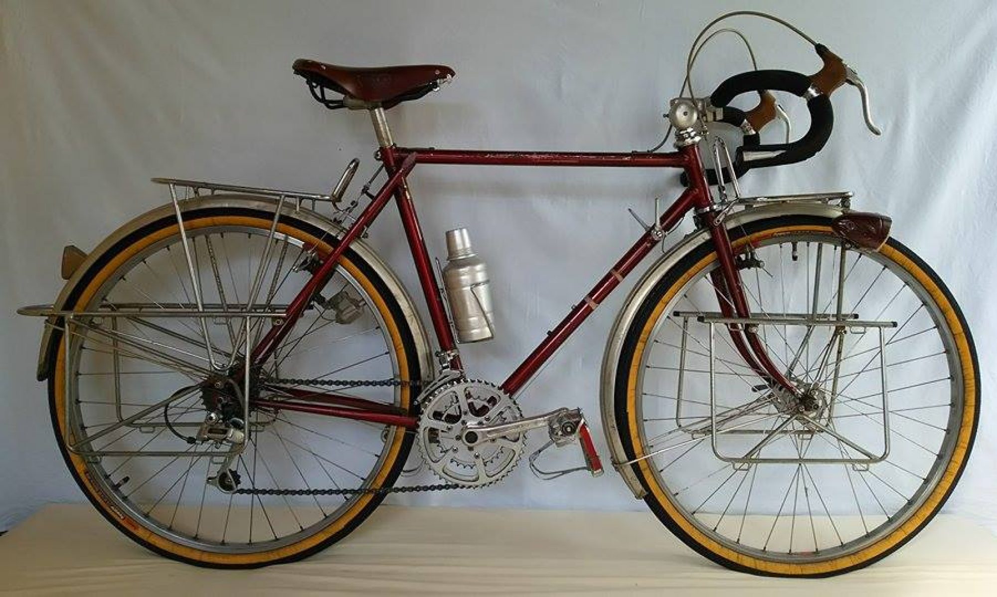
| スマホのない時代の自転車旅行 |
|---|
| In 1982, I set out on a bicycle trip to experience the vastness of the Earth firsthand. At the time, the exchange rate was 240 yen to the dollar (now 150 yen to the dollar), and Japan was in the midst of a wave of anti-Japanese sentiment. I was in my early 30s back —that was 45 years ago. Starting with the United States and Canada, I spent a year and a half cycling through 23 countries, covering a distance of over 30,000 kilometers. However, I still felt something was missing…In 1989, I embarked on a bicycle trip around Japan. That journey covered over 10,000 kilometers, bringing my total distance traveled—including my overseas trips—to 42,000 kilometers. I felt satisfied that I had finally “rounded out” my journey to the equivalent of circling the globe. I’ve published over 540 blog posts about my cycling trips over the past decade. Hoping to give as many people around the world as possible a glimpse of what travel was like in the pre-smartphone era, I’ve decided to include English translations alongside the original Japanese. I’ve currently finished translating about two-thirds of the posts, and the growing number of international readers is encouraging me to continue the remaining translation work. (November 2026) |
| 地球の大きさを体感したくて自転車で旅に出たのが1982年、1ドル240円(現在1ドル150円)、ジャパンバッシングの最中でした。私は30代前半、今から45年前になります。 アメリカ、カナダを皮切りに1年半かけて23ヵ国を走り、走行距離は3万キロを超えました。しかし物足りなさも残り……1989年、日本一周の自転車旅へ。その距離は1万キロを超え、海外の走行距離と合わせて4万2千キロとなり、地球一周のつじつま合わせに満足した自分がいました。 10年前に掲載した自転車旅のブログ記事は540あまり、世界のより多くの人にスマホのない時代の旅行を少しでも感じてもらえたらと思い、英文を併記することにしました。現在3分の2ほど英訳を終えていますが、海外の閲覧者も増え、残りの翻訳作業の励みにもなっています。(2026年11月) |
40,000 km around the world
I wanted to run 40,000 kilometers around the world.
In November 1983, having secured my return flight reservation and finished sightseeing in Taipei on the first day, I called my mother in Japan from the hotel to say, “I’ll be back the day after tomorrow.”
Returning earlier than planned meant there would be more time for my father’s memorial service scheduled for December, which relieved my mother. Though I didn’t say it aloud, I thought to myself, [Making it back safely is the best way to honor my mother].
Thursday, November 17, 1983. [Japan in just three hours? It’ll be over in a flash.] I set off from Taiwan, my final country visited, bound for Narita Airport. A year and a half had passed since I’d departed from Narita via Hawaii for Los Angeles the previous May.
Countries visited: 23 + Hong Kong. Distance traveled: approximately 31,000 kilometers. Starting funds: ¥2.4 million. Remaining balance: ¥600,000. That means I spent ¥1.8 million over 18 months. That works out to about ¥100,000 per month, which I think is roughly equivalent to living in an apartment in Tokyo at the time.
With my safe return (?), I will now conclude this “Bicycle Travel Blog.” Starting in January 2016, three years have passed, and the number of posts reached 500.
Initially, relying on memory to keep writing, I updated the blog almost daily. [I figured it would be over in a year]—that was the mindset I carried as I continued.
However, as I began sharing my writing with others, I started wondering, “Is it really okay to keep writing based solely on the materials and memories from that time?” I decided that the content should be accurate after all, so I resolved to re-examine and verify any points that raised doubts or left me unsatisfied.
Checking my own old materials was a given, but adding online searches and trips to the library to research books, newspapers, and magazines meant that updating my blog gradually took more and more time. As a result, I settled into a pace of three posts a week, and despite the journey lasting only a year and a half, it took me three years to finish.
I incorporated newly discovered facts from verification work, as well as changes in circumstances between then and now. I was advised to clearly cite these references and sources, but frankly, there were simply too many to manage that. The new knowledge gained was beneficial for me personally. Tracing my own journey felt like taking the trip a second time, allowing me to build upon my original experience.
Finally, thank you to everyone who followed this blog. Thank you for sticking with my clumsy writing and uninteresting content until the end. I also want to express my gratitude to my friend, who is also an MTB buddy. He encouraged me to start this blog and taught me all sorts of things when I knew nothing about making it happen.
Why Cycle Around Japan?
Six years after this journey, in 1989, I cycled around Japan for half a year, from Rebun Island in northern Hokkaido to the small remote islands of Okinawa in the south. The reason was that I felt unsatisfied with the 31,000 kilometers I had covered during this year and a half of overseas cycling.
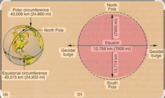
When I left Japan, I vaguely thought, “I wonder if I could ride about 40,000 kilometers, the distance around the world.” Even after returning home, I kept thinking, “If I had ridden another 10,000 kilometers, it would have been the distance around the world.”
The distance traveled around Japan was about 11,000 kilometers, bringing the total to roughly 42,000 kilometers—meaning I’ve finally (?!) cleared the distance equivalent to circling the Earth once.
I had only two rules for traveling around Japan. One was to visit every prefectural capital in all 47 prefectures. The other was to definitely drink local sake. Both were a breeze. [Oh, and local shochu too.]

1983年11月、帰国便の予約も取れ、初日の台北観光を終えるとホテルから日本の母親へ「明後日、帰るから」と電話を入れました。予定より早く帰ることで、12月に控えた父親の法要に余裕ができることに母親も安堵していました。私は口には出しませんでしたが[無事に帰れたことが親孝行だな]そんな思いでいました。
1983年11月17日(木)。[3時間もすれば日本か、あっという間だ]最後の訪問国、台湾から成田へ向けて帰国の途に就きました。前年の5月に成田からハワイ経由でロサンゼルスへと出発して一年半が経過していました。
訪問国23ヶ国+香港。走行距離約31,000キロ。所持金240万円の残金は60万円、18ヶ月で180万円使ったことになります。月にして10万円、当時の東京でのアパート暮らしとほぼ同程度だと思います。
無事に帰国したことで(?)今回をもって、この「自転車旅のブログ」を終了させていただきます。2016年の1月から始めて3年経過し、掲載数は500となりました。
当初、記憶に任せて書き続けていたこともあり、毎日のようにブログをアップしていました。[1年もあれば終わるだろう]そんな思いで続けていたのです。
ところが他人に読んでもらうにあたり「当時の資料や記憶だけで書き続けてもいいもんだろうか?」と疑問を持ち始めました。やはり内容は正確であるべきだと、疑問を持ったり納得がいかない事柄に関し、改めて調べて確認することにしたのです。
自分の古い資料のチェックはもちろん、ネットでの検索、また書籍や新聞、雑誌などで調べるために図書館に出向いての作業も加わり、いつしかブログのアップに時間がかかるようになりました。その結果、週3回ペースに落ち着き、1年半の旅にもかかわらず終了するまで3年も要してしまったのです。
確認作業などにより新たに知り得た事柄、また当時と現在の状況の変化なども書き入れました。それらの引用や出典を明記するようアドバイスを受けましたが、何ぶんあまりにも多すぎてそこまでに至りませんでした。
新たに知り得たことは、私自身にとってもプラスになりました。自らの旅を辿りながら2度目の旅行をしている気分になり、経験の上乗せができたと思っています。
最後に、このブログをフォローしてくれた皆さん、つたない文章、つまらない内容に最後までお付き合いをいただきありがとうございました。そしてブログを勧め、形になるまで何もわからぬ私にアレコレ教えてくれたMTB仲間でもある友人に感謝を伝えたいと思います。
どうして日本一周?
私はこの旅の6年後の1989年、北は北海道の礼文島から南は沖縄の小さな離島まで半年かけて自転車で日本一周をしました。それというのもこの一年半の海外自転車旅の走行距離31,000キロに物足りなさを感じていたからです。
日本を発つ時に[地球一周分の4万キロぐらい走れないかな]と漠然と思っていました。帰国後も[あと一万キロ走ってたら地球一周分になってたのに]そんな思いでいたのです。
日本一周の走行距離は約11,000キロ、ということでトータル約42,000キロ、ついに(?!)地球一周分をクリアしたのことになります。
日本一周に際しての決め事は二つだけ。一つは47都道府県、全ての県庁所在地を訪れること。もう一つは必ず地酒を飲むこと。ともに楽勝でした。[あッ、その土地の焼酎もです]
Hokkaido[0]: photos

I’ve moved the domain for my “Overseas Cycling Travel Blog” https://joyscycle.com, which I maintained for three years, to https://bikeride.travel.blog.
This blog will primarily feature photos from my trip around Japan six years after returning home. I’ve posted a few photos from Hokkaido as a preview.
3年間続けた「海外自転車旅のブログ」https://joyscycle.com のドメインを https://bikeride.travel.blog に移動しました。
このブログでは、帰国から6年後に日本一周した時の写真を中心にアップしていくつもりです。今回その一部、北海道での写真をいくつか載せてみました。


I’m riding along the Pacific Ocean-facing “National Route 336 (Golden Road)” from Cape Erimo to Hiroo Town. The “Golden Road” earned its name because the construction costs were enormous due to the road running along sheer cliffs. The center photo shows the harvesting of “Hidaka Kombu” seaweed.
「襟裳岬」から広尾町への太平洋に面した「国道336号線(黄金道路)」を走ります。「黄金道路」は、断崖絶壁を行く道路のため工事に莫大な費用がかかったことからその名がつきました。中央の写真は「日高昆布」採りのようすです。 Continue reading “Hokkaido[0]: photos”
Honshu 1-1: First, head north on Route 6
Today, May 1st, Japan transitioned from the Heisei era(1989-2019) to the new Reiwa era(2019-). This time, with the Emperor abdicating while still alive, the entire archipelago is enveloped in a celebratory mood, with fireworks launched across the country. It certainly feels quite different from the previous era change following the previous Emperor’s passing in 1989.
I set out on my journey around Japan in late July 1989, the first year of the Heisei era—30 years ago now. Six months had passed since the change, and the new era name “Heisei” had already become familiar.
It was the height of summer. “I’ll start from the north for now,” I decided, heading north from Tokyo along National Route 6.
今日5月1日、「平成」から新元号「令和」に改元されました。今回は生前退位ということもあり、各地で花火が打ち上げられるなど列島全体がお祝いムードに包まれています。やはり前回の天皇陛下の崩御による改元とはかなり違っています。
私が日本一周へ出発したのは、その前回改元された平成元年1989年7月末、今から30年前になります。改元から半年が過ぎ、新元号「平成」もすでに馴染んでいました。
季節は夏真っ盛り。「とりあえず北から回ろう」東京から国道6号線を北上することにしました。

In the Katsuta area of Ibaraki Prefecture, heavy rain brought traffic to a standstill, but after passing through Hitachi on Route 6, I reached the Pacific coast. I then entered Miyagi Prefecture from Shinchi Town in the Hamadori region of Fukushima Prefecture.
茨城県の勝田周辺では大雨で走るに走れず足止め、その後6号線は日立を過ぎると太平洋岸に出ました。そして福島県の浜通りの「新地町(しんちまち)」から宮城県へと入ります。


Arrived in Sendai. From Aoba Castle, you can see the entire city of Sendai. Though called Aoba Castle, it’s just a castle site, with only souvenir shops there. The photo below shows the decorations for the famous Sendai Tanabata Festival, which would begin two days later. The area around Sendai Station has well-organized blocks, giving the cityscape a clean, uncluttered look.
仙台に到着。「青葉城」から仙台市内を一望できます。青葉城といっても城址、そこにあるのは土産物屋だけでした。下の写真は二日後に初日をむかえる名物「仙台七夕」の飾りつけのようすです。仙台駅周辺は区画が整っているので街並みがスッキリと見えました。


Sendai is the terminus of Route 6. From here, we head north on Route 45.
After passing Sendai, I head toward “Matsushima, one of Japan’s Three Scenic Views.” The weather isn’t ideal, and what appears to be floating are the bay sightseeing boats. In the next photo, you can see the JR logo, but at that time, the Sanriku Railway (Minami Rias Line) was already operating as a third-sector railway. And then, scenes from the “Port Festival” in Kesennuma, held while keeping an eye on the approaching typhoon.
仙台は6号線の終点。この先は45号線を北上します。
仙台を過ぎると「日本三景・松島」へ、天気がいまひとつ、浮かんで見えるのは湾内遊覧船です。次の写真、JR のロゴが見えていますが、当時すでに「三陸鉄道(南リアス線)」は第三セクターとして営業していました。そして気仙沼の「港まつり」のようす、近づく台風を気にしながらの開催です。


From Kamaishi, past Ōtsuchi Town to the “Kirikiri Tunnel.” Passing through this tunnel brings you to the town of Kirikiri. Kirikiri became known through the 1981 novel “Kirikiri People” by Inoue Hisashi(1934-2010). However, the novel’s setting is not here but at the prefectural border with Miyagi. The middle photo shows the scenery from Route 45, away from the coastline; it has quite a few ups and downs.
Finally, a glimpse of camping. For my overseas bike trips, I used a single-person shelter-style tent, but for my Japan tour, I opted for a spacious two-person tent for better livability. Camping often meant pitching the tent in parks, but when no park was available, I’d make do with small vacant lots. This time, it was beside a cornfield.
Next, I’ll head through Lake Towada towards Oma Port at the northern tip of the Shimokita Peninsula, where ferries depart for Muroran, Hokkaido.
釜石から大槌町を過ぎ「吉里吉里トンネル」へ、このトンネルを抜けると吉里吉里の町に出ます。吉里吉里は1981年に発行された井上ひさし氏の小説「吉里吉里人」で知られるようになりました。しかし、小説の舞台はここではなく宮城県との県境に設定されています。真ん中の写真は海岸線から離れた45号線からの風景、結構アップ・ダウンがあります。
最後は野宿のようすです。海外自転車旅では一人用のシェルター型テントを使用していましたが、日本一周では居住性を求めて広い二人用のテントにしました。野宿は公園にテントを張ることが多いのですが、公園が見つからない時はちょっとした空き地を利用させてもらっていました。この時はとうもろこし畑の横です。
この先は十和田湖を経て、北海道室蘭行きのフェリーが出る下北半島の北端、大間港を目指します。
Honshu 1-2: Around the Shimokita Peninsula
After passing through Kuji, I entered Aomori Prefecture, heading from Hachinohe to Towada City. In Towada City, I parted ways with Route 45 and headed toward Lake Towada along the Oirase River. The Oirase River is the only river flowing out of Lake Towada.
久慈を経て青森県に入ると八戸から十和田市へ。十和田市で45号線と別れ、奥入瀬川沿いを十和田湖を目指しました。奥入瀬川は十和田湖から流れ出る唯一の川になります。


The lush greenery of the Oirase Stream and Lake Towada. It reminds me of the elementary school Japanese language textbook “The Princess trout of Towada.”
緑濃い「奥入瀬渓流」と「十和田湖」です。小学校の国語の教材「十和田のひめます」を思い出します。

Retracing our steps along the Oirase Stream, I headed toward Mount Hakkōda, opposite Towada City. The photo shows Kasamatsu Pass. On the way down to Aomori City, I stopped by “Nebuta no Sato.” The Aomori Nebuta Festival, one of Tohoku’s three major festivals, had already ended four days prior. Inside the museum, about ten nebutas were on display. This “Nebuta no Sato” closed several years ago.
Driving north from Aomori on Route 4, I merged onto Route 279 at Noheji and followed Mutsu Bay to a friend’s house in Mutsu City. The next day, starting early, he guided me on a counterclockwise tour around the Shimokita Peninsula by car.
再び奥入瀬渓流沿いを戻り十和田市とは逆の八甲田山へ、写真は笠松峠です。青森市内へと下る途中「ねぶたの里」に寄ってみました。すでに東北三大祭りの一つ「青森ねぶた祭り」は4日前に終わっています。館内には10台ほどのねぶたが展示されていました。この「ねぶたの里」は数年前に閉館しています。
青森から4号線を走り、野辺地から合流する279号線を陸奥湾沿いに北上、むつ市内の知人宅へ。翌日、早朝から車で下北半島を反時計回りにひと巡り案内してもらいました。


First, to Shiriyazaki, the eastern tip of the Shimokita Peninsula facing the Pacific Ocean. Shiriyazaki is known for the “Kandachime”, a short-legged, stocky horse of the Nanbu breed designated a Natural Monument of Aomori Prefecture. They earned their name from how they stand still in the snow. The wind was strong this time, and most horses had hidden in the nearby forest. By the way, what exactly is “Saihate”?! Next, I headed to Oma Cape. Here, a stone pillar states, “This is the northernmost point of Honshu.” The next day, I took a ferry from this port to Muroran.
Next, I went to Hotokegaura on the western “blade” of the axe-shaped Shimokita Peninsula, facing the Tsugaru Strait. You can take a sightseeing boat to see the coastline lined with bizarre rock formations.
まずは下北半島の東端、太平洋に面した「尻屋崎」へ。尻屋崎は青森県の天然記念物、短足でずんぐりとした南部馬系の「寒立馬(かんだちめ)」で知られています。雪の中でじっと立つ姿からそう呼ばれています。この時は風が強く、ほとんどの馬が近くの森の中に隠れていました。ところで「最崖」って何(?!)。続いて「大間崎」へ、こちらは石柱に「ここは本州最北端の地」とあります。翌日、この港からフェリーで室蘭へ渡ります。
次に斧の形をした下北半島の西側の刃の部分、津軽海峡に面した「仏ヶ浦」へ。遊覧船で奇岩の続く海岸線を見て回ることができます。


As dusk approached, I headed to the sacred site of Osorezan near Mutsu City for the day’s final destination. The very name “Sanzu River” suggests it separates this world from the next via a drum bridge. Crossing the drum bridge and walking a short distance brings you to the mountain gate of Osorezan Bodai-ji Temple; Osorezan is a proper temple. I heard this drum bridge is now too dilapidated to cross.
Venturing deeper into the temple grounds, the surroundings become milky white rocks. Amidst the pervasive smell of sulfur, several “such-and-such hells” await. Continuing further, the path connects from Sai no Kawara to Gokuraku Beach on the shore of the caldera lake, Lake Usoriyama. The Sanzu River is the only outlet flowing from Lake Usoriyama. Beyond the mountain in the photo lies Ōminato and Mutsu Bay.
Within the temple grounds, besides the lodging, there are four hut-like hot spring facilities, including mixed-gender baths. Anyone can bathe for free after paying the entrance fee. As darkness fell completely, I took a bath to wash away the day’s sweat.
Next time, I’ll be touring Hokkaido.
夕暮れが迫る中、この日の最後にむつ市に近い霊場恐山へ。その名も「三途川(さんずのかわ)」、太鼓橋によってこの世とあの世を隔てているそうです。太鼓橋を渡ってしばらく行くと恐山菩提寺の山門へ、恐山はれっきとしたお寺です。この太鼓橋ですが、今は老朽化で渡れなくなったと聞きました。
境内から奥に進むとあたりは乳白色の岩々に。そして立ち込める硫黄の臭いとともにいくつもの「何とか地獄」が待ち受けています。さらに進むと「賽の河原」からカルデラ湖「宇曽利山湖(うそりやまこ)」の湖畔の「極楽浜」へと繋がっています。宇曽利山湖から唯一流れ出ているのが三途川です。写真の山の向こうが大湊、陸奥湾になります。
菩提寺の境内には宿坊の他に混浴を含め四つの小屋風の温泉施設があり、入山料を払うと誰でも無料で入湯できます。あたりが真っ暗になる中、ひとっ風呂浴びてこの日の汗を流しました。
次回から北海道を巡ります。